What is the difference between latitude/longitude and Easting/Northing?
Latitude/longitude, Easting/Northing, X/Y are ways we uniquely identify a position on Earth and are also called coordinates. There are 2 coordinate systems namely geographic and projected.
A geographic coordinate system uses a spherical surface and a position is identified by its latitude and longitude. Latitude and Longitude are angular units of measure and are denoted in degrees minutes and seconds or decimal degrees. The Longitude values range between -180 to +180°. Latitude values range between +90° to - 90°.
When we create a map we project a sphere (Earth) onto a flat surface and we use projected coordinate systems to do this. The latitude and longitude are converted to X and Y coordinates. During this transformation the surface of the earth is distorted. There is no perfect map projection and one chooses a projection based on what distortion is acceptable for their purposes. Projections is a complex topic which I do not intend to touch upon in this article. After transformation Latitude is denoted by Y (northing) and Longitude by X (Easting). The most common units of measure in projected coordinate systems are meters and feet. For example UTM is a common projection, a location is identified with easting and northing and the units are in meters.
Summarizing the above, the units for Latitude and longitude is degrees, minutes and seconds and the units for Easting and Northing is linear the most common being meters and feet. You can find several free convertors online to do the conversions for you or you can attempt it yourself in excel. Below are a 2 websites where you can convert
https://www.bgs.ac.uk/data/webservices/convertForm.cfm
https://gridreferencefinder.com/
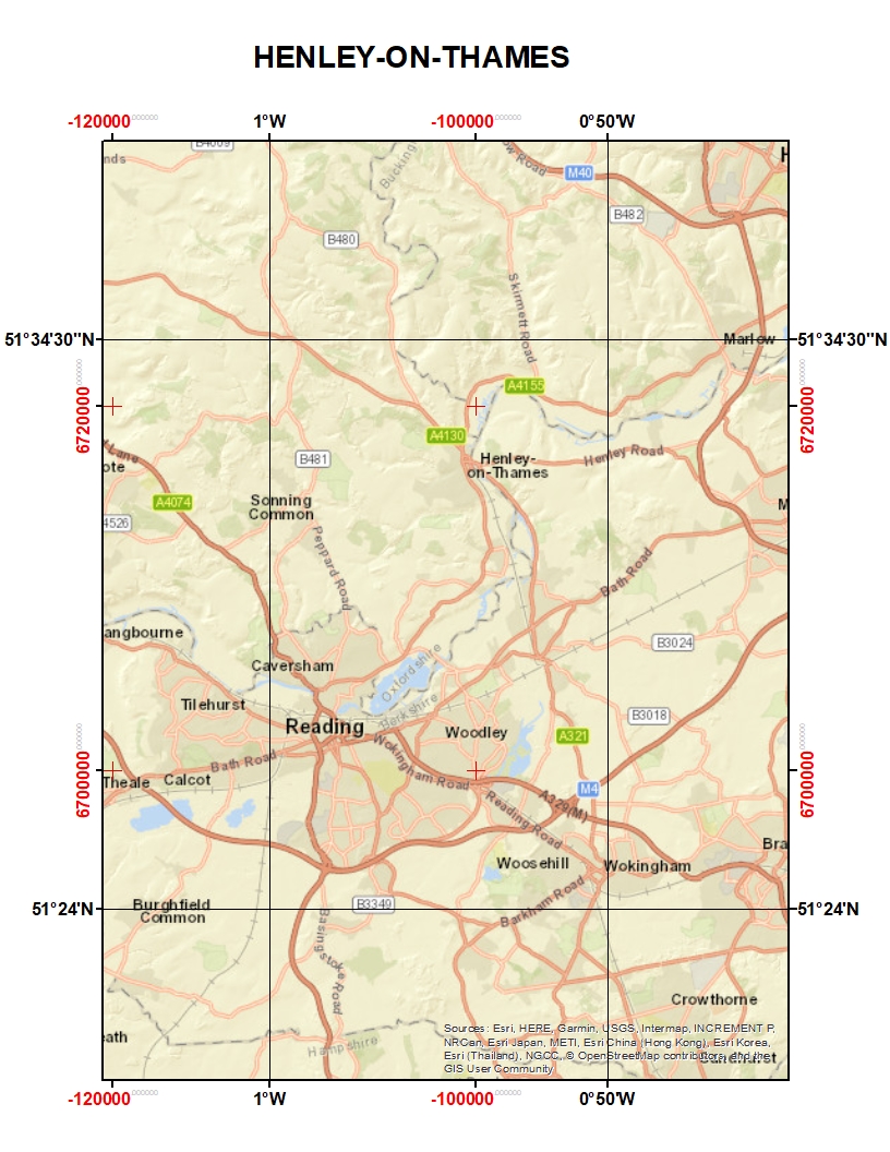
I have drawn a map below to illustrate the above explanation. The black grid lines are Latitude and Longitude and in red are the Eastings and Northings.
The position of Pitney Bowes office in Henley is
Latitude 51.553299 Longitude -0.92593001
X(Easting) 474565 Y (Northing) 184370
Grid reference: SU 74565 84370
If you have a large number of coordinates to convert then this is best done within a GIS software. How this is achieved would be the topic of another article.
------------------------------
Susan Bardet
Software Support Engineer
susan.bardet@pb.comPitney Bowes
Henley-on-Thames
RG9 6AB Oxfordshire
pitneybowes.com
------------------------------