Hi John,
With all this discussion about digit zipcodes, I thought I'd share details on the British Postcode system as we do tend to get a lot of questions around it with customers outside the UK sometimes struggling to understand the Postcode Sector, Postcode District and Postcode Area layers in our UK postcode boundary product PostMap UK.
The United Kingdom Postcode system was designed independently of any administrative boundaries so it will not align to them cleanly and may cross administrative boundaries in some cases. The Postcode Sectors, Districts and Areas naturally align within their own geography.
The UK Postcode system starts with the Full Unit Postcode, e.g. "AB12 3DE", the postcode unit represents on average 15 households and was originally modeled on "a postman's walk". There are over 1.6 million postcodes in the UK. It is challenging to capture the polygons at this level as with so few households within each unit postcode they can be found representing individual floors of high rise buildings and some business locations may have multiple postcodes where they are large users. Ordnance Survey, the UK mapping agency captures this data in their Codepoint with Polygons product.
The next level of postcodes up from Unit Level (e.g. "AB12 3DE") is the Postcode sector - in this example. "AB12 3" this represents around 2500 households and is commonly used to segment demographic information.
The next level above postcode sector is Postcode District, so taking our example of a unit postcode "AB12 3DE" , the postcode district that this unit postcode falls within is "AB12" this represents around 8,500 households.
The final level of UK postcode boundaries is Postcode Area. Taking our example of a unit postcode "AB12 3DE", the postcode area that this unit postcode falls within is "AB" and this will contain approximately 190,000 households.
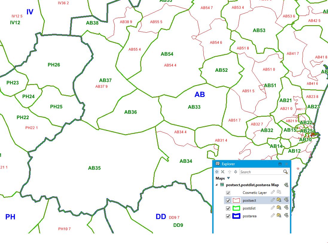
The above image shows how the postcode sectors, districts and areas nest within each other.
------------------------------
Daniel Edwards
Product Manager, Location Intelligence Data
Pitney Bowes Software Ltd
HENLEY-ON-THAMES
------------------------------
Original Message:
Sent: 03-21-2019 16:33
From: John Tagliaferro
Subject: Post Code Boundaries vs Points
Hi Dan,
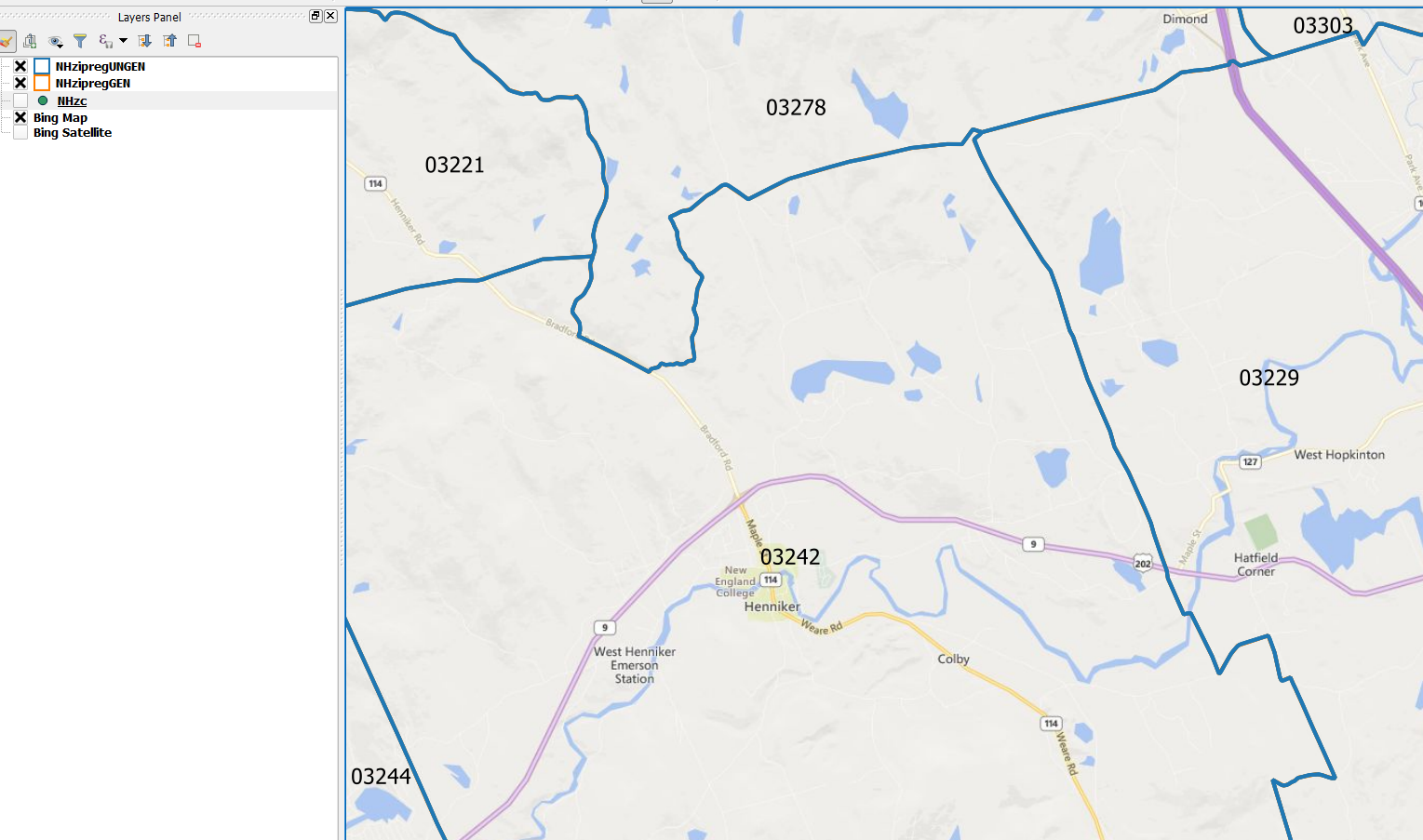
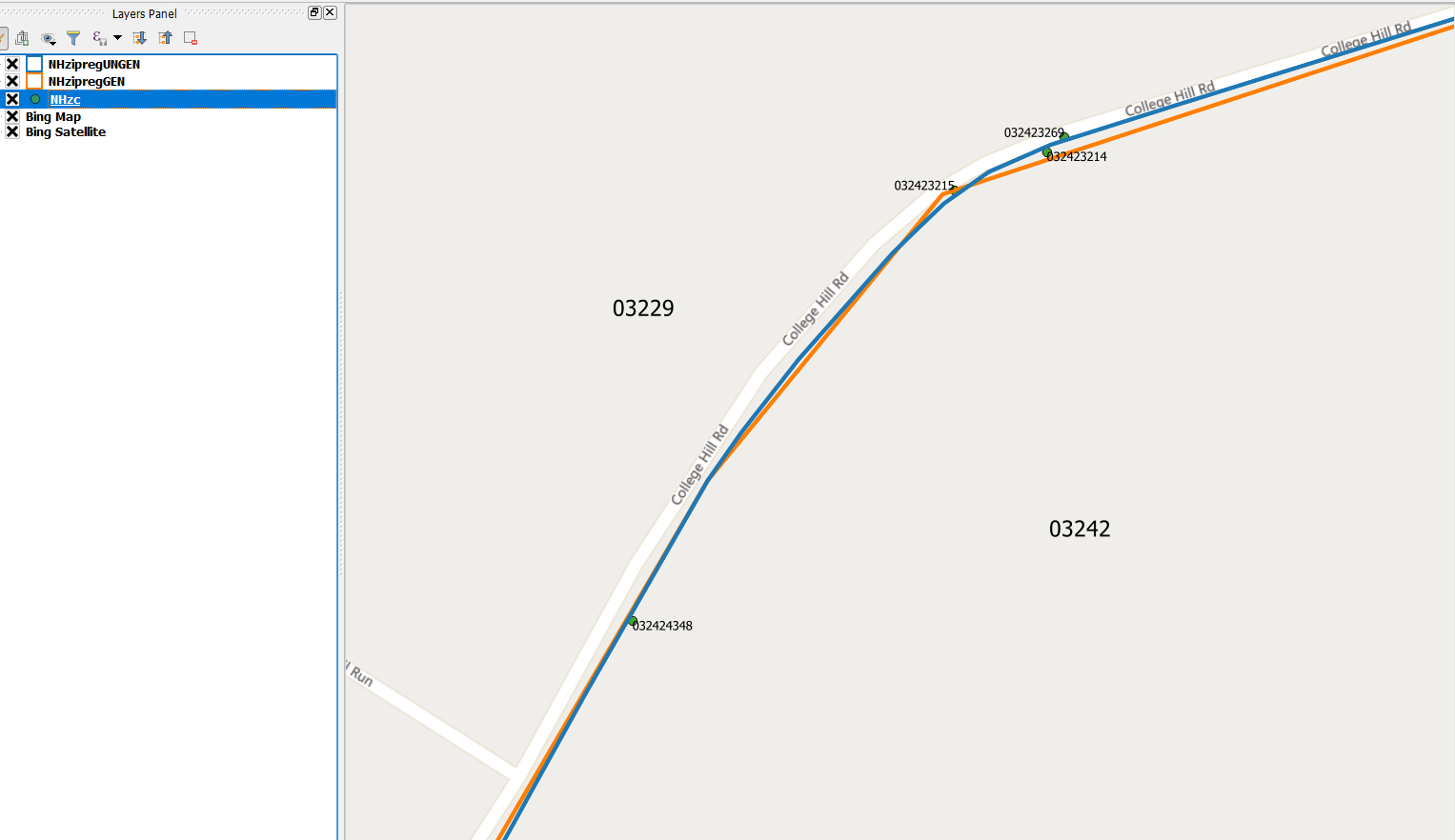
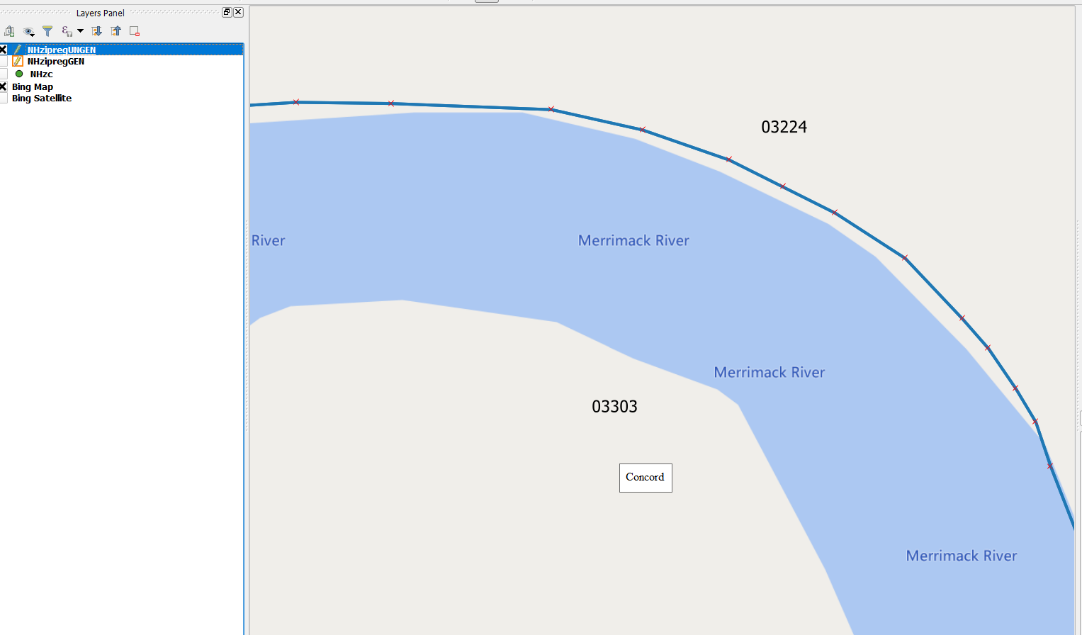
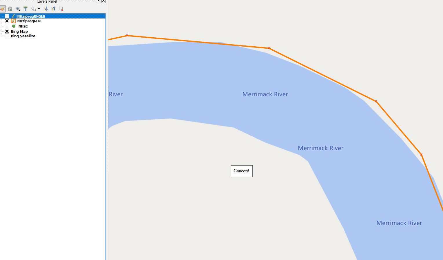
Thanks for the question. The 5 Digit ZIP code boundaries come in both generalized and ungeneralized files. I've taken some screenshots to show the differences. From a cartographic display standpoint the generalization doesn't cause the boundary to take on poor display qualities until you zoom in very close. There will be a difference however when you are dropping points along a street, especially curved streets. That can cause a point to fall on either side of a polygon depending on which flavor you choose. The fact is that there isn't a huge difference between gen and ungen ZIP codes because while there are a number of nodes that are dropped the algorithms that are used do very well to maintain shape/integrity of the polygons. Choosing generalized boundaries is primarily for those users who want to work with ZIP codes in a web application that needs high performance and quick redraw times. In general you should go with the ungeneralized - they are the most detailed and still display well.
Here are few screenshots looking at ZIP codes in New Hampshire, I've added ZIP+4 centroids in a couple as well.
------------------------------
John Tagliaferro
Product Manager LI Data
PITNEY BOWES SOFTWARE, INC
White River Junction, VT
Original Message:
Sent: 03-19-2019 13:01
From: Dan Adams
Subject: Post Code Boundaries vs Points
John, thanks for the information on how PB represents postal boundaries and postal points. I know one of the challenges in creating boundaries is deciding on the level of generalization vs. detail used in creating a boundary. Generalized boundaries tend to be more fit for thematic mapping and display, where more detailed boundaries may be better for point-in-poly analysis. Would you comment on the different criteria that is used in deciding how to generalize postal boundaries and what users may want to consider when selecting a postal boundary for different applications?
I'm curious because I'm talking with a student that would like to conduct detailed analysis for a market study. She has a set of GPS data collected from a mobile phone app, and she would like to ensure she is assigning the correct ZIP code to clusters of the data, so precision and accuracy are important. However, she would then like to create images for display and I'm concerned that if she used the same, detailed boundaries for display, she is going to end up with a map that looks odd (and ugly).
------------------------------
Dan Adams
Pitney Bowes
VP, Data Product Management
White River Junction VT
Original Message:
Sent: 03-14-2019 12:25
From: John Tagliaferro
Subject: Post Code Boundaries vs Points
As a PM for world postcode boundaries I'm often asked do we have boundaries for all the postcodes in a given country? Or why don't we have boundaries for 6 digit postal codes in Canada or 8 digit postal codes in Brazil?
It's important to understand a bit more about how postal code boundaries are commonly generated. Remember first that a postal code boundary does not typically exist in reality. Postal codes are a means of delivering mail and don't need to conform to administrative or natural boundaries. They are created using a combination of postal delivery points and routes and building blocks of geography. When you have enough delivery points a boundary becomes possible.
When you look at the whole of postal codes and types of delivery in a postal system however, you encounter postal delivery types that are unique businesses, post office boxes, military collection centers. When we create postal products we commonly represent these as points, not polygons because they have specific locations. So within our 5 digit ZIP code product in order to represent a full roster of postal codes you would be working with both points and polygons.
For postal codes like 6 digit codes in Canada (local delivery units) and ZIP +4's in the USA, these often represent street sides and multi unit dwellings. Centroids are then generated for a representative location vs attempting to render a polygon for such a localized area.
Finally, our products often include centroids pre-calculated for boundaries allowing you to have a full roster of postal codes as points. Polygons however are typically reserved for postal codes where they can derived with the right criteria being met.
------------------------------
John Tagliaferro
Product Manager - LI Data Product Team
PITNEY BOWES SOFTWARE, INC
White River Junction, VT
------------------------------