MapInfo Pro

 View Only
  • 1.  Count overlapping polygon regions

    Posted 02-23-2019 11:38
    I have a question regarding the following:

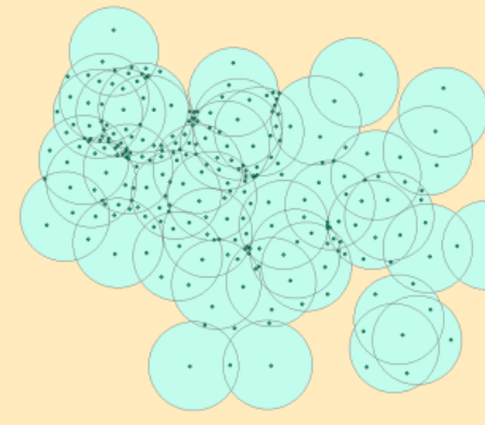
    I used the concentric rings tool to create areas of 500 metres around all of the points I had on a map. It looked a bit like the image below.

    The thing is I need to count the amount of intersections for each area so as to then make queries like areas of the circles with more than 5 inteseccions and later join those areas.

    Any help on this will be highly appreciated.

    Thank you


    ------------------------------
    Ignacio Barraza
    Knowledge Community Shared Account
    ------------------------------


  • 2.  RE: Count overlapping polygon regions

    Posted 02-24-2019 21:14
    Hi @Ignacio Barraza - Fantastic spatial problem to solve! <g class="gr_ gr_1818 gr-alert gr_gramm gr_inline_cards gr_disable_anim_appear Punctuation only-ins replaceWithoutSep" id="1818" data-gr-id="1818">Yes</g> this should be possible.

    Like most things there are probably a few ways to achieve <g class="gr_ gr_1756 gr-alert gr_gramm gr_inline_cards gr_disable_anim_appear Punctuation only-del replaceWithoutSep" id="1756" data-gr-id="1756">this,</g> if I understand your requirement correctly here's one way to go about it (using a mock dataset to be similar to the one you have):
    1. Create a copy of your table (Save Copy As), using the new copy (let's call it "Buffer_Split") select all objects
    2. Under Spatial ribbon >> Set Target
    3. Now do a Split using the original table. Select everything from your Original table & Split Target. This creates individual polygons for each of the overlaps
    4. Add a new field to Buffer_Split (Table>>Table>>Modify Structure) of Integer type
    5. Do a Column Update, count the number of objects that overlap each Buffer_Split object using the original table, put this value in the new field created above
    6. You can now easily run a query to find all the polygons with >5 value or just use it to create a thematic that really makes the concentrations pop - check this out!


    is this what you had in mind?

    ------------------------------
    Ashley Crane
    Regional Director, Software Support
    Pitney Bowes
    ------------------------------


  • 3.  RE: Count overlapping polygon regions

    Posted 02-25-2019 21:30
    If you have MapInfo Pro Advanced then the raster processing tools give you an alternative solution.

    You can use the "Hotspot Density" gridding technique to create a raster that contains, in each cell, the count of the number of samples that are within a defined radius of the centre of the cell. In its simplest form, you will get a result exactly like the one that Ashley has described and you will see the same kind of circular artefacts in the raster. There are other options that can give you a smoother and more pleasing result.

    If you are only interested in areas where the sample count within the radius exceeds a certain level then you can use the raster rendering tools to clip out the unwanted data interactively or you can run a calculator operation to permanently clip out the cells where the sample count is below a threshold. If you want, you can convert this raster back into polygons for further analysis.

    I have included a couple of images for illustration.

    ------------------------------
    Sam Roberts
    Engineer, MapInfo Pro Advanced (Raster)
    Australia
    ------------------------------


  • 4.  RE: Count overlapping polygon regions

    Posted 02-25-2019 21:35
    <g class="gr_ gr_34 gr-alert gr_gramm gr_inline_cards gr_run_anim Punctuation only-ins replaceWithoutSep" id="34" data-gr-id="34">Thanks</g> @Sam Roberts - the MapInfo Pro Advanced option is much more elegant to implement + produces results which are pleasing to the eye. Great stuff!

    ------------------------------
    Ashley Crane
    Regional Director, Software Support
    Pitney Bowes
    ------------------------------


  • 5.  RE: Count overlapping polygon regions

    Posted 02-26-2019 08:04
    Hi Ignacio,

    Have a look at this thread from the predecessor to these forums. It gives a few approaches to a very similar problem:

    https://groups.google.com/d/topic/mapinfo-l/0E2CgAvZI8I/discussion

    Cheers,

    Andy

    ------------------------------
    Andrew Harfoot
    GeoData
    University of Southampton
    ------------------------------


  • 6.  RE: Count overlapping polygon regions

    Posted 06-18-2019 06:53
    Hi Ignacio,

    This is a few months after your post, and you're likely not to read this, but maybe it could help someone else if they come across this.

    You can achieve this through SQL using the AreaOverlap() function. This function not only returns objects that intersect one another, it also returns the size of the area that is overlapping (this helps if you need to determine % of overlap).

    You make a copy of you buffer table and then query them against each other.

    Example SQL
    AreaOverlap SQL Example
    This would return something like this
    AreaOverlap SQL Result Example
    Then on the result table, you do a count of SourceID, which will return the number of other buffers that intersect each one
    Count SQL Example
    Which would return this
    Counts Result SQL Example
    You can then query any ID where NumIntersects > 5. You could query directly using the counts result or you could save the results and update a new column in your original table.

    Hope this helps someone.

    ------------------------------
    Simon Emmanuel
    Spatial Solutions Manager
    Salmat Digital
    Prestons
    ------------------------------